
Day 47 | Mile 703.4 – 723.4
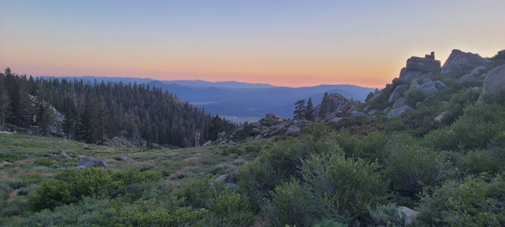
First day into the Sierras! Everyone was excited to get moving. We steadily climbed all day out of Kennedy Meadows South ending at an elevation just over 10 000 ft. We’d stay above 10 000 ft. for most of the next 3-4 weeks.
Day 48 | Mile 723.4 – 744.2
Slow morning leaving camp around 7:45am. My tent blew down once in the night. I was pretty low energy all day. The climb from the day before and the elevation was already taking a toll. I struggled pushing the final miles of the day.
Day 49 – 50 | Mile 744.2 – 775.3 + Mt. Whitney
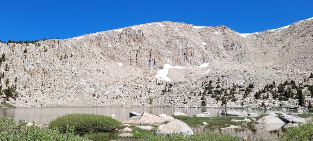
We stopped at Chicken Spring Lake for our first swim in a “duck” lake! A “duck” lake gets its name after the symbol used as a waypoint on the map denoting the location of a notable lake – why the symbol is a duck, I’m not sure. There aren’t any ducks even near these lakes.
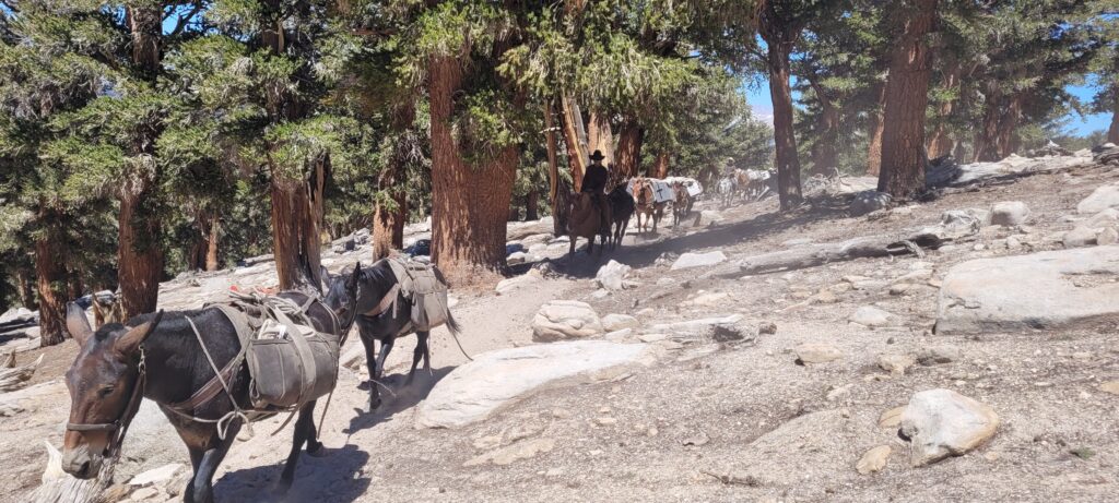
After our swim, we were passed by a mule train which are still mainly used in the Sierras to bring supplies to interior range ranches and different backcountry trips.
I struggled through the latter half of the day with the elevation and pushing out the final miles. Hiking ended around 8pm when Ri and I finally made it to camp with the rest of the group. The others had arrived slightly before us and had started planning the Mt. Whitney summit. Ri and I were informed the current plan was to leave camp around 1am to reach the summit for sunrise. This left us with around 2.5 hrs of sleep to capitalize on before starting the climb.
Mt. Whitney is a side quest on the PCT that most thru-hikers undertake. Mt. Whitney is the highest peak in the lower 48 US states and also marks the Southern Terminus of the John Muir Trail (JMT) that proceeds north through the high Sierras. For PCT hikers, the summit is a 16-mile round trip, 4500′ gain, off-trail adventure.
We quickly ate our dinners that evening, prepared our food and bags for the late night departure, and then hit the hay. We left most of our food and heavier items behind to “slack pack” to the summit and then return to camp. We brought some snacks, water, warm clothes, and quilts/sleeping bags.
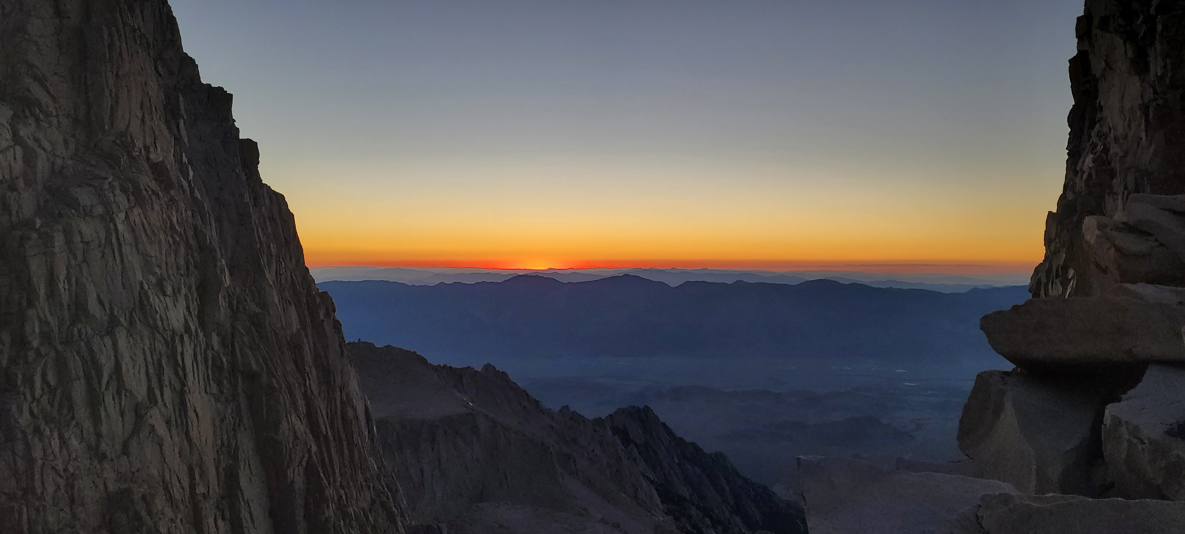
I woke up at 12:40am and we were underway by 1:15am. I struggled to keep up with Lando and Ri and decided to slow down to my own pace. Up ahead, we could see other hikers headlamps navigating the switchbacks in the dark forming red and white light constellations up the mountain side. It was an epic sight and very motivating for me to continue.
I ended up doing most of the climb by moonlight, appreciating the subtle balance of soft light reflecting off the nearby lakes and the darkness of the shadows. On the way up, I had to rest a couple of times to reduce my heart rate, catch my breath, and eat some snacks. The elevation was wearing me down and I could really feel it in my chest.
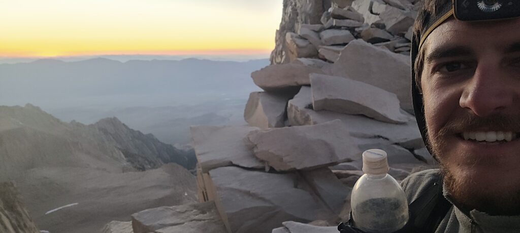
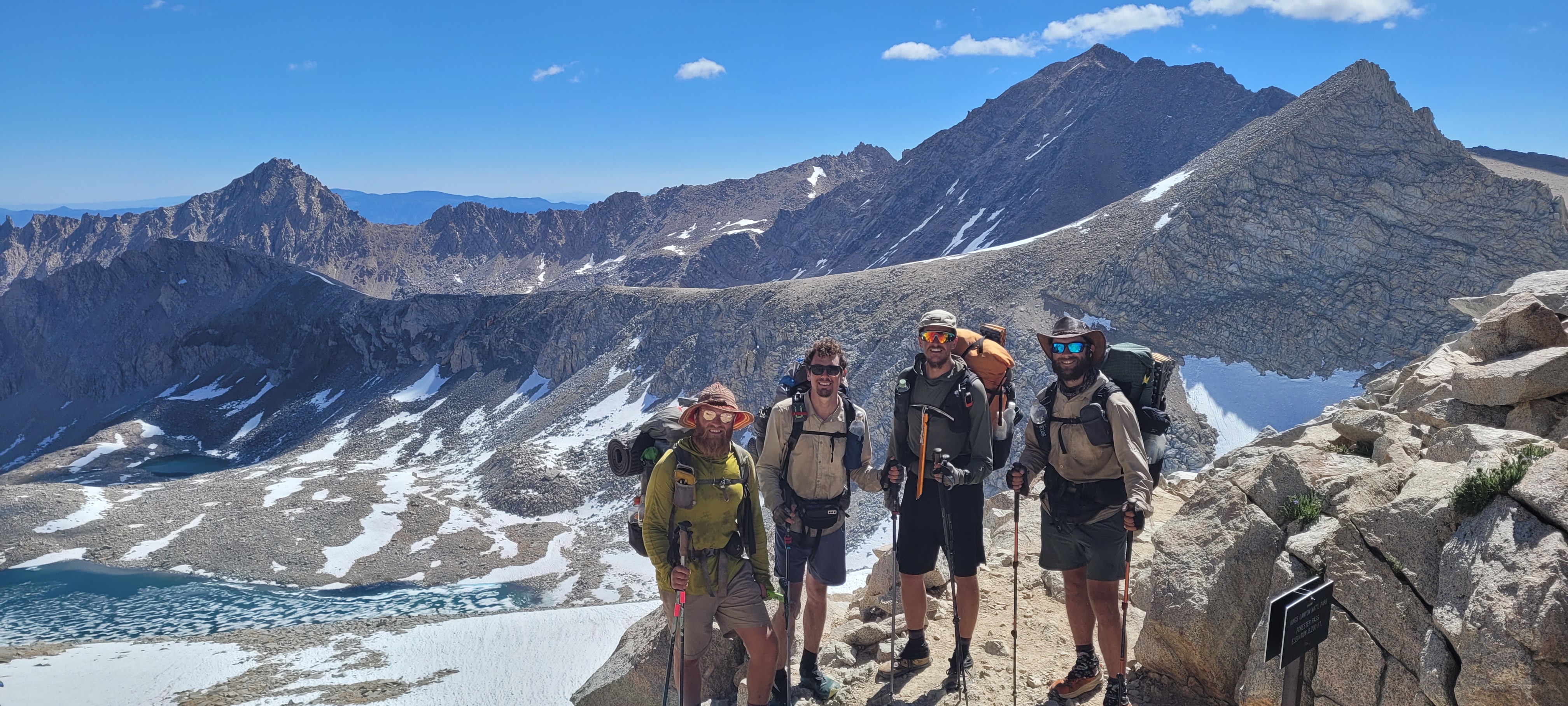
In the end, I was about 200 ft. below the summit for sunrise but had a clear view of it over the Sierra range through the spires beside the peak. I made it to the peak about 15 minutes after the other guys and was greeted by a couple dozen familiar hiker faces.
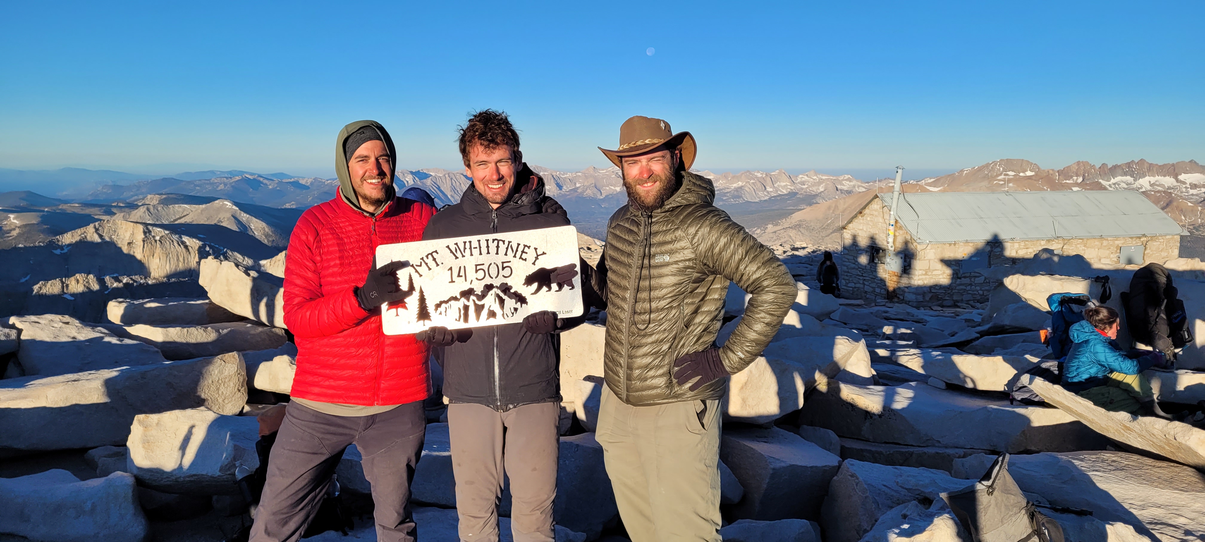
We made it.
I hung out at the summit for about 2 hours and was one of the last to descend that morning. On the way down, there were about a dozen day hikers that were making the ascent. When I had made back down to the bottom of the switchbacks, a Search and Rescue helicopter showed up and airlifted a hiker from the junction near the summit via a suspended harness. We had heard of at least two other rescues in the days around when we summited.
Back at camp, we all napped for a few hours around noon before packing up to do another 8 miles back on the PCT.
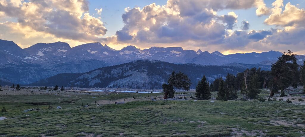
We passed over a wide open plateau with incredible views of Mt. Whitney to the East and a vast range to the West reflecting off a lake. We decided to camp slightly beyond this point to avoid wind and so we could rest at a lower elevation.
What a day.
Day 51 | 775.3 – 789.7 + Side Trail | Forester Pass & Kearsarge Pass
From camp, we had to cross a river immediately and then steadily climbed for 5 miles to the top of Forester Pass. Forester Pass marks the highest point along the entire PCT at 13 120 ft. The final 0.5 mile of the climb is steep switchbacks up to the saddle where you are rewarded with big vistas to the North and South.
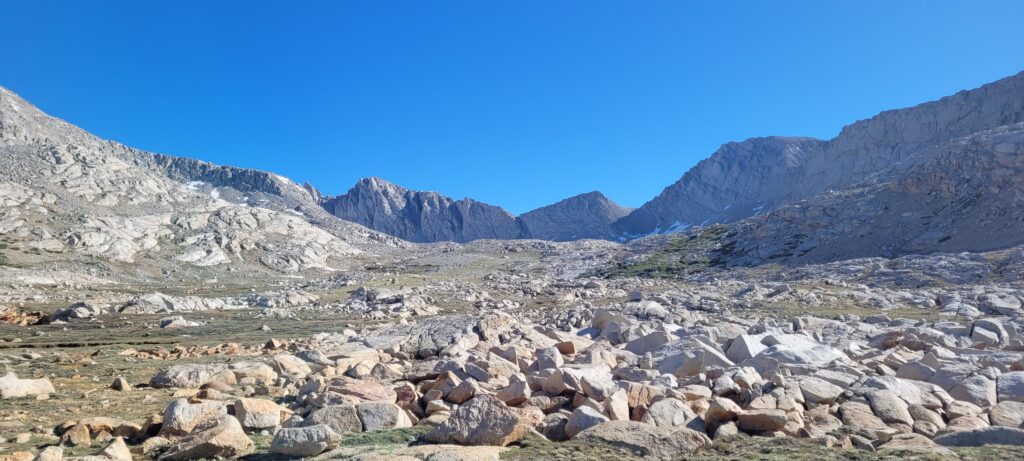
Descending off Forester, we slid down the snow and had to route-find our way through some snow covered sections of trail. At the base of the initial steep descent was a lake, the highest elevation lake we’d encounter on trail, with about half of it still ice covered. We jumped in. I may have yelled. But my gosh, was it ever refreshing.
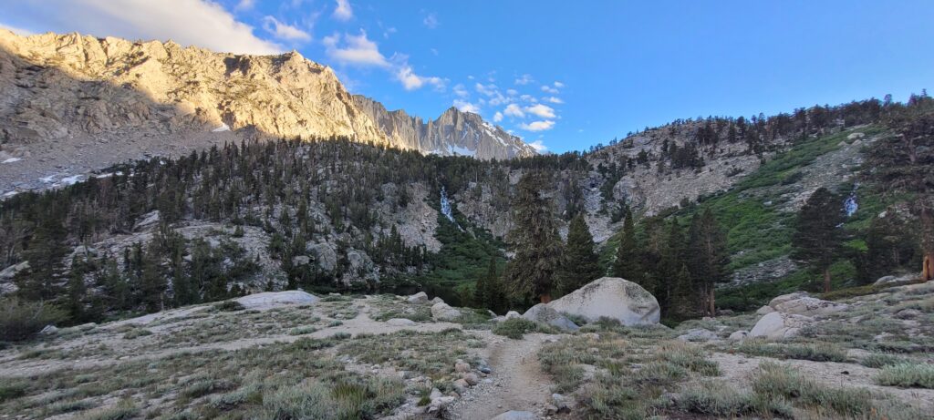
Since Crabtree Meadows where we camped near the base of Whitney, the environment completely changed to full blown alpine and Sierra majesty. Cresting Forester and and descending into Kings Canyon National Park was breathtaking; endless waterfalls and streams, huge snow capped peaks, and beautiful pines.
2023 was a very high snow year for the Sierras with snow pack in the 200% range in certain locations. The evidence of that for us this year was visible through multiple, couple hundred yard sections of destruction caused by avalanches across the trail.
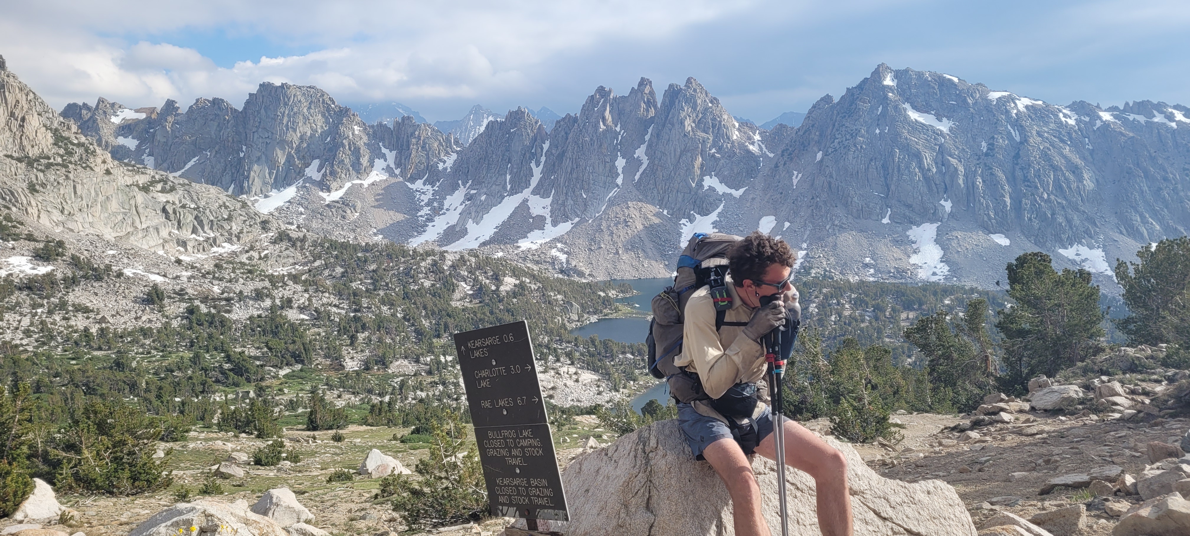
Our goal was to also tackle Kearsarge Pass which involved another few thousand feet off trail to the Onion Valley Trailhead on the East side of the Sierra range. This would take us into the town of Bishop for a needed break. We parted with Pandora at the Kearsarge Pass junction with the PCT and had to say goodbye. He would continue on another few days to eventually meet up with his partner for a visit in town. It was tough to say goodbye not knowing whether or not we’d see him again. At the time of writing this in late August, almost two months later, we haven’t crossed paths with him but still keep in touch checking in with each other.
We made it to the town of Independence around 8:30pm after receiving a ride from a trail angel to get down the mountain to the desert floor. Rides from Independence to Bishop were looking bleak until another hiker managed to get us a ride from a solo guy doing a road trip. The guy was heading the opposite direction from Bishop but gave us a ride 2 hrs out of his way to help us out. The kindness of strangers continues to blow me away. Thanks to him, we made it to Bishop that night and had a bed to sleep in.
Wow! Gorgeous views!! I’m sure snow was a nice change after all the desert. Hike Mike Hike!
Oh man what a great read… I already can’t wait for the next one. I am always so impressed by everything you’ve accomplished! The views are incredible!!!
Yay a post!!
The picture of Riley at Kearsarge Pass says it all – he DOES look tuckered out!! But what a view behind him.
I had no idea about the mule trains, seems a unique way of transporting goods in this day and age. Tried and true I suppose.
Very cool to come across them on the trail.
Those ice water dips must be just what you need to refresh the body, as the mountain views must refresh your soul.
I love the picture on top of Mt Whitney, you all look so happy, even though you just went through hell to get there.
And the scenery is breathtaking. Literally. 😉
What a sense of accomplishment on this entire hike, it must be so rewarding. We are all so proud of you!! Hike Mike Hike!!
Can hardly wait for the next post – stay safe. xo
Gorgeous views, an experience like no other.
Reading this whilst travelling from Birmingham to North Wales, I have been momentarily transported across the world to the summit of Mount Whitney.
I now have to work my way backwards through your previous blogs.
Safe journey to you all !!!
Glad to see amother blog post – Absolutely beautiful photos!
That beard must have kept you warm through the snowy trails 🙂
Hike Mike Hike!
Here he is:)
My goodness Mike what a true accomplishment. When I tell you how excited I am to see you, it goes beyond measure!
I can only imagine for you it is bittersweet. The lifelong friendships you have made, the views you get to wake up and go to sleep with, the adrenaline rush, the once in a lifetime experiences ! It must all seem so surreal that you are almost done!
These photos are absolutely stunning and I love that the polar plunges are going strong!
You all truly look so happy which brings me so much happiness seeing these photos. The butt-sliding would have been a blast and lovely to get off of your poor feet! haha
I love you so much, stay safe and soak in every second, minute, hour, day and week left on trail Mikey.
HIKE MIKE HIKE !!!
xo
Wow…what an amazing adventure! Wonderful memories and great pictures. Enjoy the last leg of your journey.
Stay safe
Incredible!