

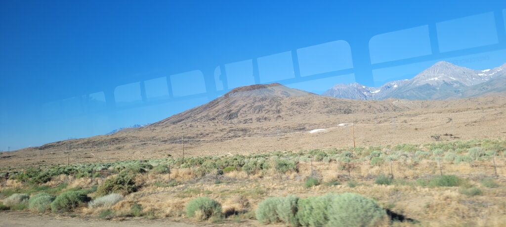
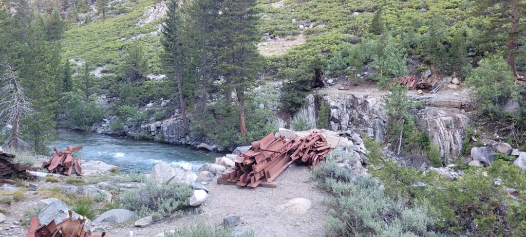
Day 52 – 53 | Bishop
Our stay in Bishop was a much needed break from the overall elevation increase and daily elevation gain. It was filled with loads of food and lots of rest. Our motel was directly across the street from McDonald’s to which we were frequent visitors. Bishop itself is a fun desert town with a big focus on outdoor adventure. There were a number of cycling, climbing, and hiking-focused stores which made gear shopping and resupplying a breeze. I was pleasantly surprised to have a variety of shoes available in my size to try and test out. Finally, I was able to replace my Altra’s that had served me from Julian (around mile 77) in the desert. Needless to say, I was ecstatic to have some new wheels.
We had planned on only staying one day in Bishop but the rest was too nice. We all agreed to day an extra day to slow the pace of the resupply and prep for the next section. The next stretch would be about seven days and 115 miles (185 km) between towns and resupplying. The guilt was real but so were the McDouble’s.
Day 54 | Mile 790.3 – 794.7 | Kearsarge Pass, Glen Pass, & Rae Lakes
We caught the 7am bus from Bishop to the town of Independence where we attempted hitchhiking for about an hour to no avail. In the interest of hiking time, we ended up calling the same trail angel who picked us up from Onion Valley to bring us back up to the Kearsarge Pass trailhead. From the trailhead it was a 2 600 ft. climb over ~4 miles to the top of the Pass and another ~3 miles to rejoin the PCT. When we reached the top of Kearsarge, we were greeted with our first bout of forest fire smoke. A small fire had broken out in King’s Canyon and the smoke was travelling through the valley.
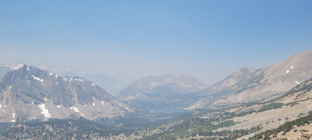
With our only options being head back to town or continue on, we decided to keep moving forward and hope the smoke did not continue over the next pass. You could smell and feel the smoke a little but it was bearable. Once we reached the trail, we immediately started to ascend Glen Pass. The climb up Glen Pass was steep and rocky but just a sample of the passes to come. There wasn’t much talking between the three of us as we pushed to make it to Rae Lakes for the night.
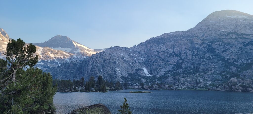
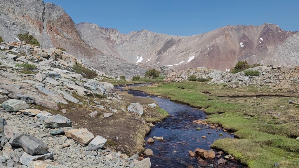
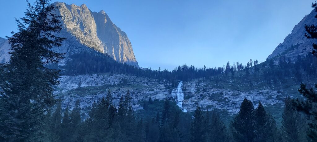
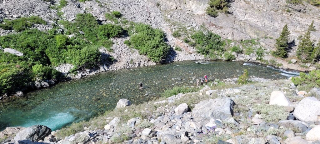
After a quick snack break at the top, we descended the North side down into Rae Lakes. Rae Lakes delivered on the hype from other hikers; it was gorgeous. There were JMT (John Muir Trail) hikers there fishing the ice-cold waters. We crossed the creek flowing between Upper & Middle Rae which was brisk. Where we camped at Middle Rae Lake, we were able to look to the South and see Glen Pass and our traverse down off in the distance. We sat by the water’s edge, ate our chicken ramen dinners, and climbed in our tents.
Day 55 | Mile 794.7 – 812.5 | Pinchot Pass
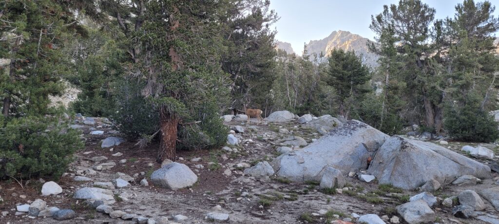
I woke up to a small buck passing through our camp; an natural alarm I do not mind.
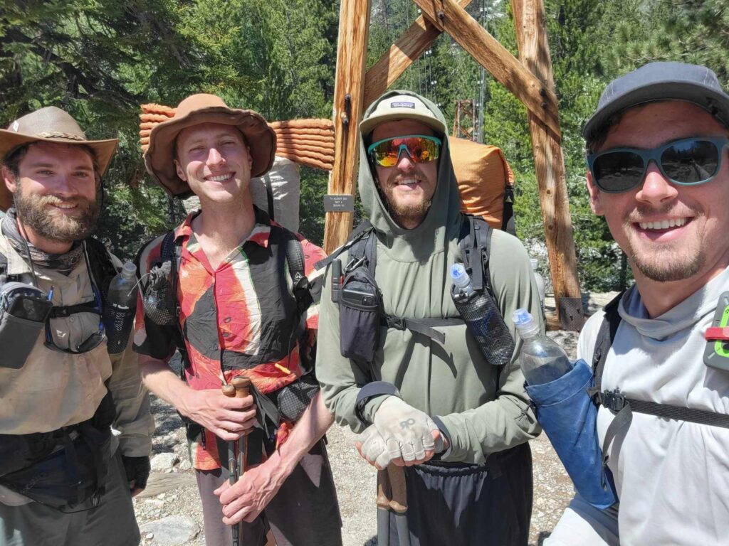
The descent from Rae Lakes to Woods Creek was quite the scramble due to avalanches the previous year. The trail was largely covered and blocked by downed trees forcing us to find alternate footpaths through the valley. We crossed the 800 mile mark as re reached Woods Creek took a quick refreshment break before crossing the Creek. Just as we were about to cross, who comes strolling up to the bridge? None other than our old friend “Bath Time” who we haven’t seen in weeks! He was going by the name “Can Do” stemming from his upbeat attitude. It was great to see him.
We crossed Woods Creek and hiked with Can Do for next hour or so before he, in the most Can Do/Bath Time thing he could do, decided to stop for a trail-side nap. The creek marked the start of the Pinchot Pass ascent consisting of ~8 miles and ~3 300 ft. of elevation. The trail brought us next to Woods Creek Waterslide which would most definitely be the last waterslide you ever rode. It was unanimous that Pinchot Pass was the most grueling Pass so far. I think it was largely due to the length of the climb coupled with it not being a gradual trail, but instead 12 to 18 inch steps the whole way.
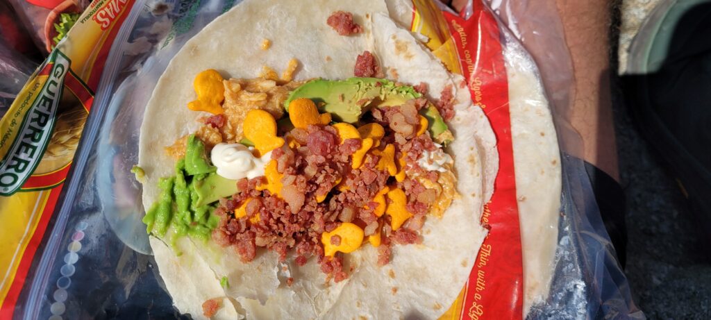
We reached the crest one by one and had a much needed lunch break. The first day or two out of town, I tried to make my lunches a bit more exciting with some fresh produce; avocados and spinach were choice. Today’s lunch consisted of pouched fajita chicken, avocado, mayo, Goldfish, and bacon bits – that’s living, baby.
As cooked as my legs were doing Pinchot, the beautiful tundra grasses, flowing creeks, and pristine lakes had me floating and made the fatigue not only bearable, but enjoyable.
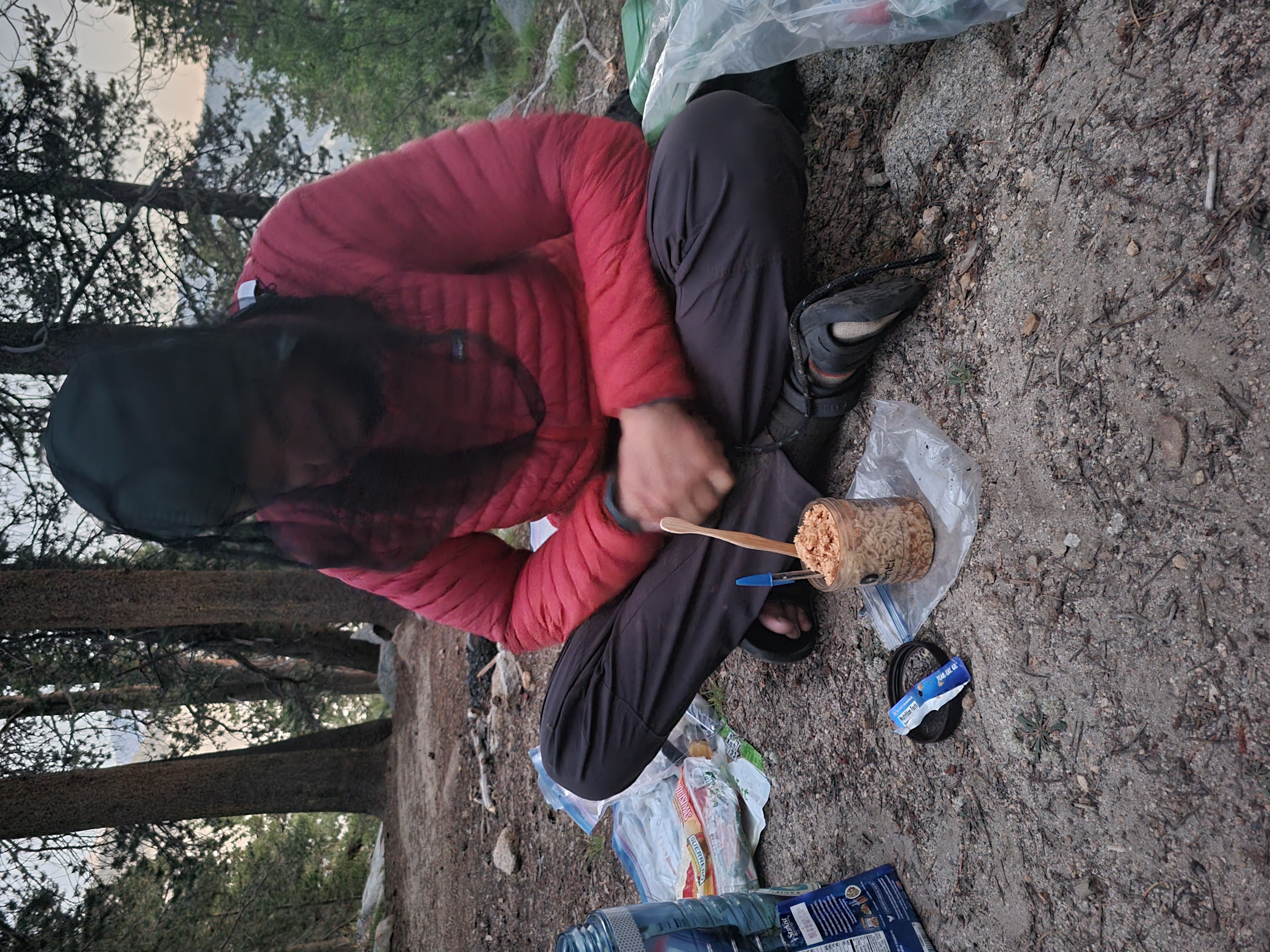
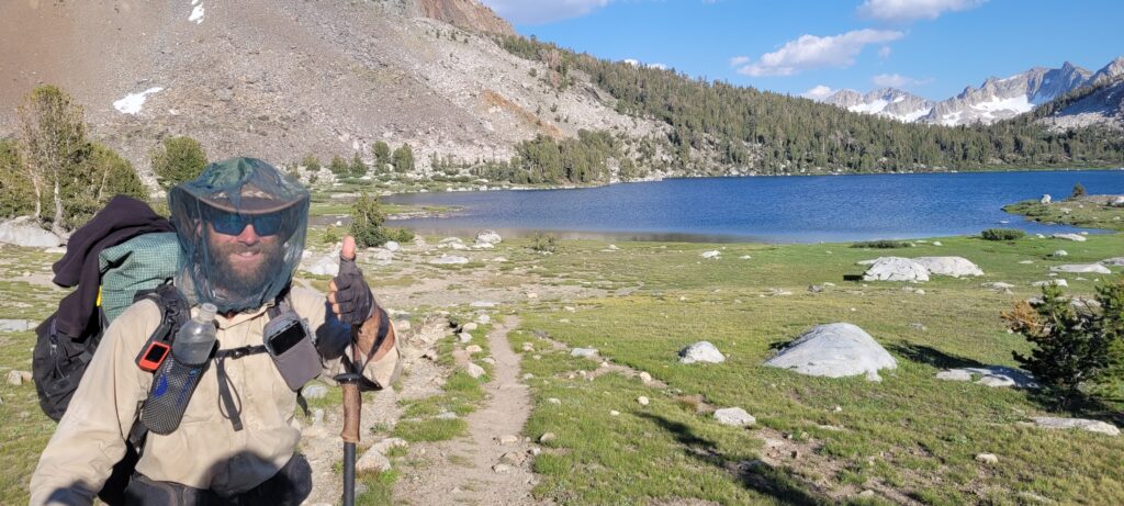
I would be remiss if I didn’t mention the torrent of mosquitos that engulfed us on the descent side of Pinchot before making camp. I thank Bishop-Michael for having the foresight to purchase a bug net. Now, they weren’t Northern Ontario level mosquitos but at a certain point, even mosquito density has diminishing returns.
Day 56 | Mile 812.5 – 832.2 | Mather Pass
About 100 m from camp was a creek that needed crossing. Riley led the way across with me following close behind. Now, this water somehow felt as cold as the lake at Forester Pass and my feet instantly started “burning with cold”. Riley was taking his sweet time and I was jammed up behind him trying to pass and get out of the water as fast as I could. I was laughing with disbelief at the water temperature; I’ll never forget it.
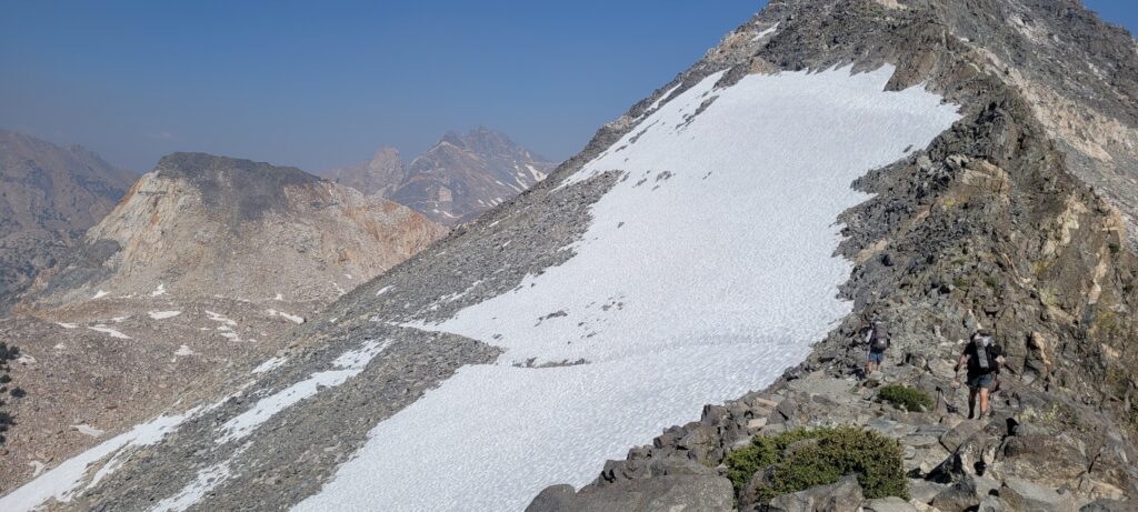
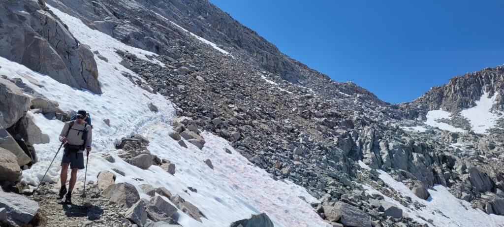
Mather Pass is known as the most “fear-inducing” pass on the trail because of its steep angles on either side of the crest. Personally, I didn’t find it too scary but the trail was hard to trace on the North side of the Pass and resulted in us scrambling down; that was scary. I was certain one of us was going to roll or twist an ankle but the three of us made it down to the trail unscathed.
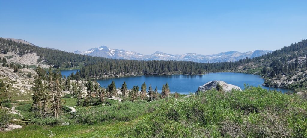
We passed by Palisade Lakes and had to stop for an obligatory cold plunge. We ate lunch alongside a curious marmot and basked in the sun.
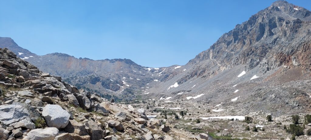
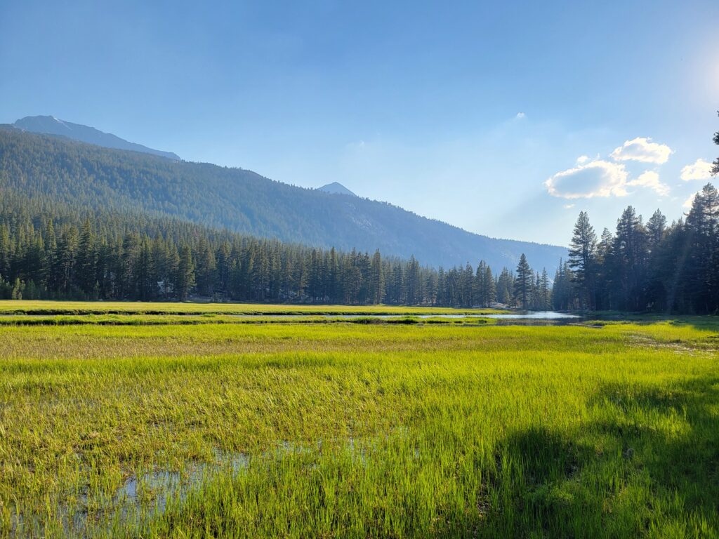
The rest of the day was a sharp descent with classic Sierras views.
We camped just before the Bishop Pass turnoff where, in the morning, we’d have to make a decision on how we’d respond to a trail closure ahead of us.
Day 57 | 832.2 – 851.9 | Muir Pass
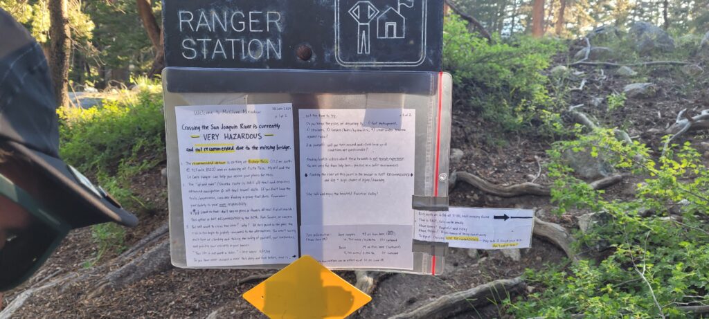
The trail ahead of us involved a major river crossing. In 2023, the steel bridge that provided safe passage was destroyed by the weight of the record-breaking snowpack. This meant the trail was…closed. There were many signs and warnings from park rangers indicating that fording the river was not advised and unsafe with notes of heli-rescues pinned to the notices. The obvious choice would then be to take the 26 to 29 mile detour, right? But we had heard from southbound JMT hikers that people had been successfully fording. We weighed our options and decided that since we hadn’t had a rainfall in a few days so river levels would be lowering and we’ve heard stories of people crossing that we were going to go for it. Worst case, there was an “up and over” option off trail that we could attempt to navigate. We’d know if we made a good choice tomorrow when it was time to cross.
We started up Muir Pass from camp and gained about ~3 000 ft. in ~8 miles. The climb wasn’t particularly difficult with short bursts of high grade followed by brief plateaus. There were a number of small water crossings and my feet did not stay dry. We passed a number of ice covered lakes and crossed a snow bridge.
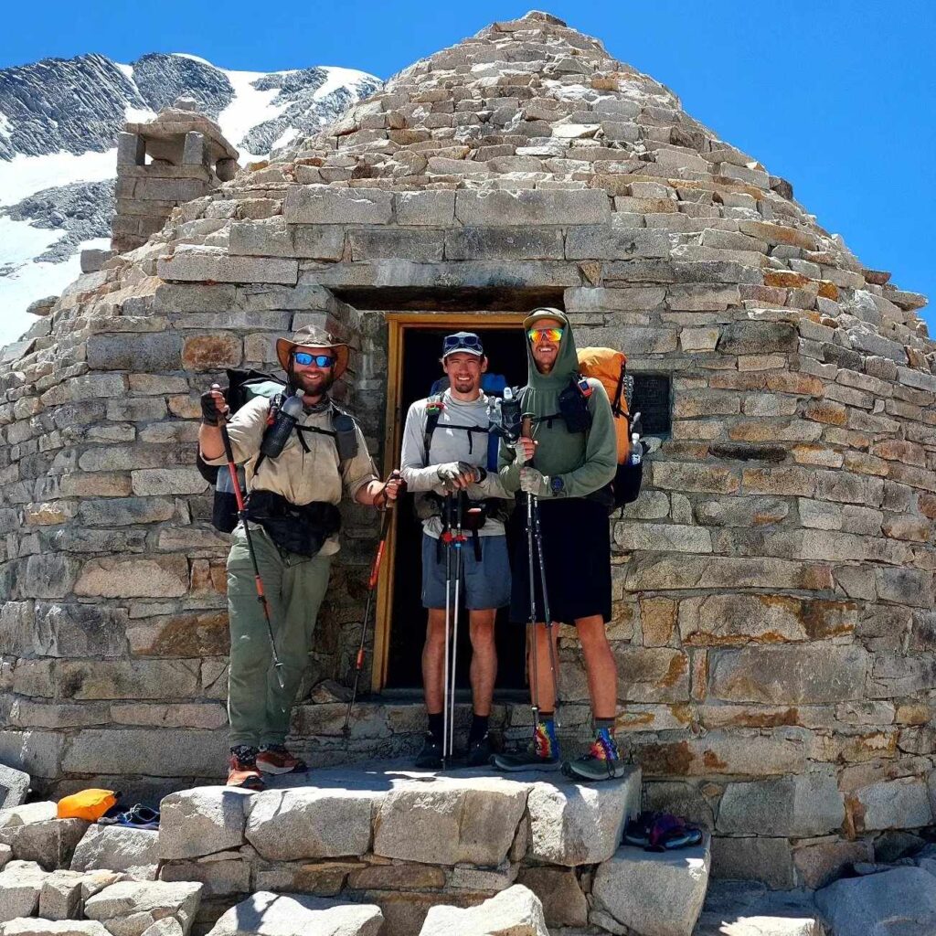
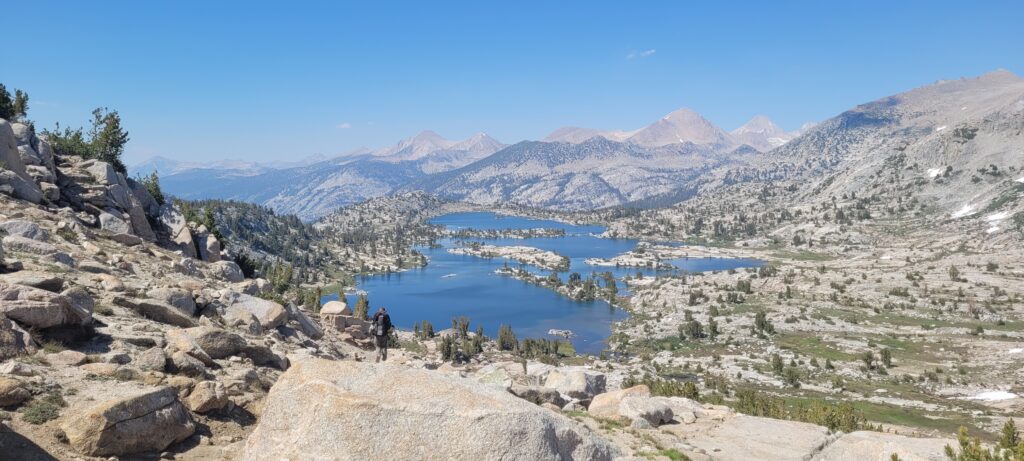
The crest of Muir Pass is home to the John Muir memorial shelter constructed by the Sierra Club in 1930. The “Muir Hut” is an octagonal stone building that once served as a refuge but is now a dedication to the naturalist. We reunited with a number of our friends inside the hut and had lunch. We made it down Muir Pass and through Evolution Meadow to get us close to the river crossing the following morning.
Day 58 | Mile 841.9 – 874.8 | San Joaquin River & Seldon Pass
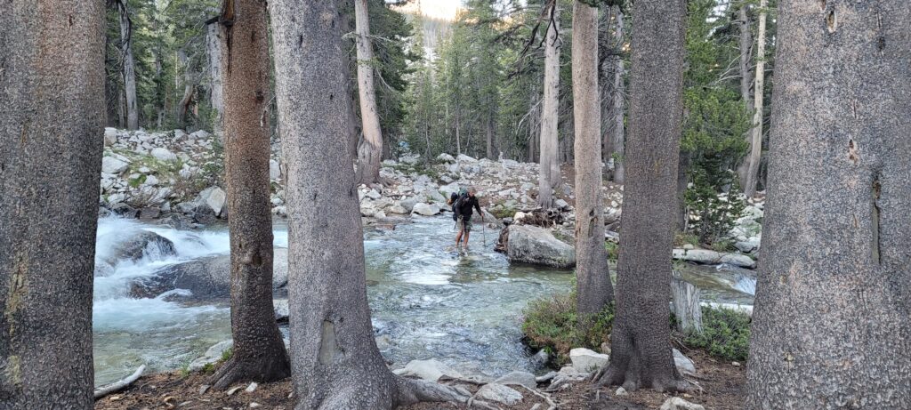
The day started with a shallow and low flowing ford of Evolution Creek followed by a descent down to the San Joaquin River. When we reached the river, the bridge that had collapsed under the snow load was disassembled and neatly piled on either abutment of the bridge crossing. We took a few moments to assess the flow; it was quick but seemingly manageable.
We heard there was a spot to cross near a bend where the water was shallower so we set out downstream to try and find it. We came to a clearing on the back which we thought must have been the correct location. It wasn’t as shallow as described and some other hikers nearby decided to keep moving downstream. However, we thought it looked passable so I went out first. About one third of the way across, I was blocked by a step-down in the riverbed and had to go back a few feet. Riley and Lando had started off just after me and took a route 10 ft. further downstream and made it across. I had to walk backwards downstream to where they made it across as the current was too strong for me to turn around.
Eventually, the three of us were safely across. I can understand that if you had little experience with rivers or around water, it could be a dangerous crossing for some. For the three of us, I think growing up near water and rivers helped us in this situation.
Down the trail a couple of hundred meters, we had an aerial view of the recommended crossing and watched others safely ford the river. The walk to the base of Seldon Pass was relaxed following the river valley. We were now entering the John Muir Wilderness area of the Sierra National Forest and were beginning to see some seriously massive trees.
We diverted onto a side trail that leads to Muir Ranch in hopes of getting some food that wasn’t from our bear cans. We gambled on the ~1.5 mile detour to the ranch trail but our dreams were crushed early when we met a group of southbound JMT hikers. They informed us the ranch was closed and that even the famous hiker box was mostly empty. Our spirits evaporated. After a couple moments of reflection, it was time to move on and start the Seldon Pass climb. Maybe it was because we had been doing so much elevation or maybe it was because Seldon was actually quite steep, but the climb from the Muir Ranch trail to Seldon Pass was one of the hardest climbs for me. Much of it was exposed to the sun, just a slog.
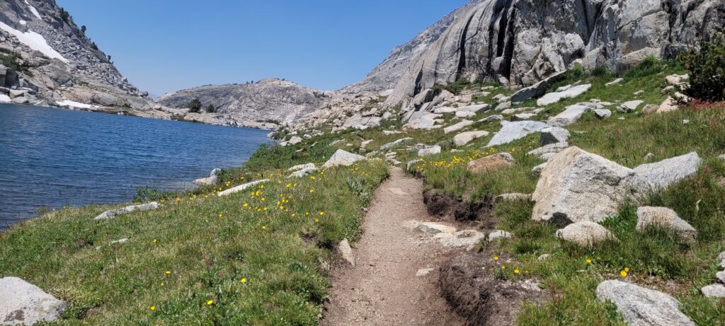
After the bulk of the climb with only ~1 000 ft. remaining, we had lunch and regrouped. Spirits nearly mended after our food fantasies were swatted down, we finished Seldon Pass and stopped on the other side at Marie Lake for a quick swim. Always essential to pause and appreciate; the sun was shining, a fellow hiker by the trail name of Banter was with us, crystal clear water, a beautiful day.
Dinner this night was one of my lowest on trail as earlier in the day, on that fateful Muir Ranch side trail, I left my spork on a log after snacking on some peanut butter. I improvised and while getting assaulted by mosquitos, I ate my ramen with a pen and toothbrush as chopsticks; it wasn’t pretty but it got the job done.
Day 59 | Mile 874.8 – 897.0 | Silver Pass
With only one more full day before reaching the next town, we were beginning to run low on food. Yes, that means meal options are limited but it also means your pack is significantly lighter which is always good. The lighter pack was especially welcome as our elevation gain over the course of the day was approximately ~5 600 ft. (1700 m).
We ran into more friends in the morning and battled mosquitos all day. We passed through Virginia Lake, a large lake where the trail is submerged along the Northern bays. The water felt nice on the legs and soothed the bug bites.
We found a very sloped area for the three of us to camp near Duck Lake that night. All of us tired and ready to sleep. Our final day in the High Sierras coming to an end.
Day 60 | Mile 897.0 – 904.5 | Mammoth Pass to Mammoth Lakes
The end of our longest stretch! We were on trail just after 6am to push to the Horseshoe Lake trailhead by 10am. We kept a good pace and played the “alphabet” game to pass the time; picking a category and naming things from that category. We played too many times to count. We came across two national park rangers doing trail maintenance work. These guys were carrying a large two-man hand saw, spades, axes, you name it they had, with the exception of gas-powered tools to not start fires. They were on a 50 mile clearing trip for two weeks.
The funny thing about getting close to popular trailheads and access points is that you can smell laundry detergent and perfume from hundreds of meters away. It’s truly shocking and you find yourself smelling strangers as they walk by (haha)! It became a running joke on trail. We made it in time for the free bus into town and managed to slip a quick plunge into Horseshoe Lake before the bus arrived. It felt completely surreal to be on that bus; no windows, wind on our faces, radio tunes on the stereo, riding into town.
Just in time for the Fourth of July!
Even though I know how this story ends (lol) I love love to read about your insights on the trail, and see photos I haven’t seen yet.
What a time!
Funny how those Timmins mosquitos prepared you for all this! Who knew? haha
The mountains and rivers are breathtaking, and I can’t imagine seeing this daily. Something you will never forget!
Thanks for the update and looking forward to the next installment xo Hike Mike Hike!
Yay glad to be reading these again and asking you questions about each entry face to face!!! Yaahoo ❤️